The big tour today. A climb from our
hotel at about 1300 metres above sea level, to a pass (Pfunderer
Joch) at about 2500 metres above sea level. All in one go.
But before that we had to wake up and
eat some breakfast. Had a rather large assortment we could choose
from, even some cake. After stuffing ourselves so we would have
enough energy but not be weighed down to much we got set, paid and
set of on our bikes. A lot of people had said that getting above tree
level on the Pfunderer Joch is fu****g steep and it is not to far
from the truth. I have biked up steeper before but not over that
length of time. At one point there was a cow fence and someone had
written "only 800 hm left" onto it, so we where working
ourselves up, slowly. Apparently it gets easier after reaching the
top tree level at about 1900 metres above sea level. The task from
then on was to have enough power or skill to be able to get up a
rocky track. Shortly before we left the tree line it started to rain,
meaning not a light drizzle, but a downpour. It carried on for a bit
of a time period, enough so we got drenched. You don't notice the
rain after a while any more, because you don't know what is rain and
what is sweat. At the same place we stayed a group left up the same
way we did about half an hour earlier, but we saw no head or tails of
them. We did see a Alpe on the way up with two vehicles in the
vicinity, but otherwise we where completely alone. The higher we went
the more it appeared we where in the Scottish highlands. We where
chased up the mountain by some clouds threatening us with rain, but
they where mostly driven back by the wind coming the other way. At
one point we had to cross a river and because it had rained rather a
bit the night before we stood in front of an un-bikable challenge.
Solution: shoes of and walk through five degree Celsius water, in the
middle of no where with only us two in the area. After nearly
freezing our toes of and getting the shoes back on we continued up.
And up and up. Higher up I heard a marmot about 30 metres away and I
got as near as 20 metres to get a picture before it disappeared. They
tend to be rather shy creatures (I think) and don't normally let
people that near to them. Carried on up and met some strange cows.
Acted like they don't know what bikers are. Shortly before reaching
the top we had to start pushing, when we heard a helicopter coming
nearer. Flew right over our head and it looked like it had a camera
mounted on the front. It hovered over the pass for a few seconds and
then flew back over us before flying over to the next stone wall and
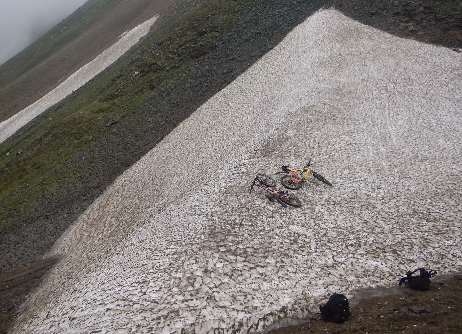
carrying on along that. After quiet some more pushing we reached the
snow field at the top and had a super view down the valley we had
come from and no view down the valley we where planning to go. Cloud
cover again. After getting wrapped up in all sorts of long clothes
(it was 8℃) we took a few pictures and then went down the other
side. The first few metres where spent walking but then it went over
into trail biking. We got lost a few times and where stopped by some
even stranger cows than before, but had a super bike down to the next
Alm with Nico biking a lot of the trail, sometimes some that looked
like they could brake the bike. Down past the Alm and further on. We
saw one bright green blob (biker) coming down from the Pfunderer Joch
but otherwise no soul up there. Underneath the Alm there was a large
amount of campers and the strangest cow. It ran away from us for a
few hundred metres, down the track we where biking. Not left or right
turn, just strait. We eventually managed to get past it with the help
of to unknowing hikers. Strange thing was, it carried on following us
for a while. Zoomed down into the valley, past rock outcroppings and
down tarmac roads.

That was also the time we started looking for a
place to eat. Found lots of inns, but all of them boarded up. We
eventually had lunch in a Pizza restaurant just before it closed.
After lunch we got rid of the sand in our socks from the river
crossing in the morning and put our long clothes in to the rucksack.
We half heartedly continued on along the main river towards Bruneck.
Instead of following the bike path all the way we took a detour
through a near forest. Lucky in that situation, as just when we
passed under the forest tree line it started raining again. Thanks to
our tree friends we stayed rather dry. After getting back on the bike
road we continued on to St. Vigil. I was there with the bike group
four years ago and biked up the same way Nico and I where going up
now. I was rather surprised once again how the valley turns from
normal valley in to Dolomite valley, steep drops and villages on the
valley sides. After rather a long uphill bike we saw the first signs
of the Dolomite mountains in the distance. Underneath that St. Vigil.
After a downhill run to the town we found a room rather fast and
while Nico went shopping I had a shower and then wrote my blog.
Searched for dinner for some time (and WLAN, but found none) but got
some in the end before going back for the night.
Time in saddle: 6 hours 2 min.
Distance: 65,33 km
Average speed: 10.82 km/h
No comments:
Post a Comment